Vier D
Home
Archiv
Seminare
Nachrichten - Twitter
4D Expertise
Gebrauchtes
Mac + iPhone: zu verkaufenFinden
Geo-Themen + Projekte
GoogleMap-Integration • GeoDDDD • Database Publishing • Database PhotographyVerschiedenes

that's about Web 2.0 and AJAX and bringing those fascinating technology into the reach of a 4D-solution. Using GoogleMaps is proof it works and we can.
Parcels and Ownerinformation atop satellite maps
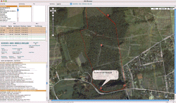
Usually you need a GIS to work with maps and geographic data. That's expensive, lot of work, much training for the user and poor or non existent third-party database-connectivity. No integration at all. Today we have 4D and the Gecko-Plugin and GoogleMap.
We are testdriving some solutions, watch the animated screenshots above as an example. If you are interested in us, creating a 4D-component or speeding you up in your own developement, send us an email about your needs!
Go for a testdrive with your browser. The map behaves identical inside 4D.
Coaching
I do provide one-on-one coaching by phone and email and iChat when my schedule allows.
Besides
Do you know about GeoDDDD, our mapping component for 4D and 4D Chart? Then have a look here.